In short
- Warnings issued on 4 October cover the Chao Phraya provinces, Phetchaburi, Chachoengsao and the South; more rain is due on Saturday.
- Ban Sang district in Prachin Buri is flooded across all nine sub-districts; only army trucks, rescue vehicles and boats get through.
- Thailand's disaster prevention department reported standing floodwater in Bangkok and 27 provinces on 4 October, with about 3.26 million people affected.
What to do
- 1Check the daily situation reports of the Department of Disaster Prevention and Mitigation before crossing the central plains.
- 2In Bangkok, avoid the roads reported as flooded: Chao Khun Thahan, Chalong Krung, Luang Phaeng and Lat Krabang.
- 3Reconfirm your train, coach or flight with the operator, especially east of Bangkok and toward Ayutthaya or Kanchanaburi.
What changed on 4 October?
A flood warning was issued on Sunday 4 October for the provinces along the Chao Phraya, and for Phetchaburi, Chachoengsao and southern provinces, because of water already on the ground and forecast rain, according to the Bangkok Post.
Deputy government spokeswoman Lalida Persvivatana said levels in the Mae Klong and Chao Phraya basins were falling, but that standing rainwater keeps the risk high, the Bangkok Post reported. At Chai Nat, the Chao Phraya barrage was releasing 2,500 cubic metres a second that day.
Residents from Uthai Thani and Chai Nat down through Ayutthaya, Nonthaburi and Bangkok to Samut Prakan were asked to follow official announcements; parts of those provinces remain flooded. Alerts also cover Bang Khonthi and Amphawa, in Samut Songkhram.
Where are the new alerts?
The Prime Minister warned that heavy rain was possible all week in the South, and that the rain due on Saturday would raise the risk in southern provinces and in Chachoengsao, immediately east of Bangkok, according to the Bangkok Post.
| Area | Reported on 4 October |
|---|---|
| Chao Phraya valley, Uthai Thani to Samut Prakan | Flood warning; parts still under water |
| Phetchaburi, Prachuap Khiri Khan | Risk from Kaeng Krachan dam releases |
| Chachoengsao, southern provinces | Higher risk with Saturday's rain |
| Prachin Buri: Ban Sang | All nine sub-districts flooded; every road cut |
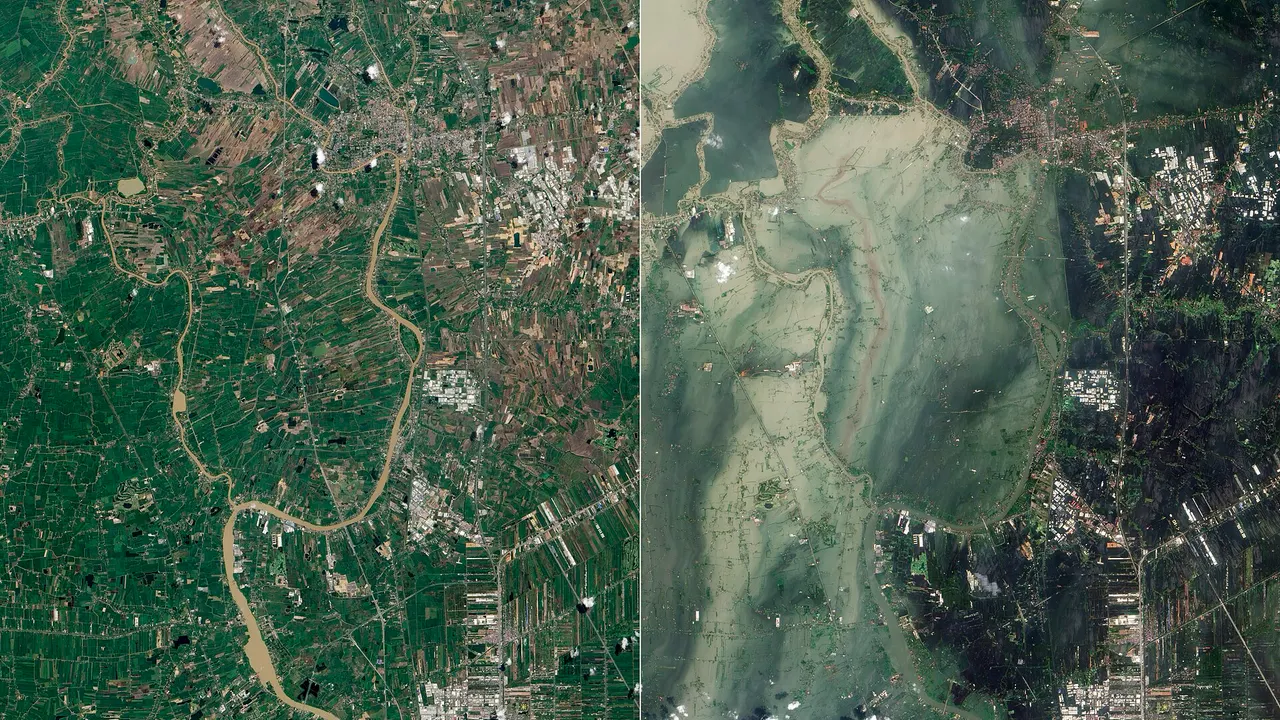
The Department of Disaster Prevention and Mitigation reported standing floodwater in Bangkok and 27 provinces on 4 October, among them Prachin Buri, Chachoengsao and Kanchanaburi. It put those affected at about 3.26 million, and the number of deaths at 31 since 16 September, four of them in Bangkok.
Why is Ban Sang cut off?
In Prachin Buri, east of Bangkok, Ban Sang district lies entirely under water. District chief officer Setthawut Wonglerwut said all 88 villages across its nine sub-districts are flooded, the district office included, and that this is worse than in 2011 and 2013, the Bangkok Post reported.
No main or secondary road is usable: nothing but military high-clearance trucks, emergency vehicles and boats can pass, and supplies are arriving by train. Fourteen shelters hold more than 700 people, which the district chief said covers most of those affected; about one resident in ten has refused to leave.
What is not affected?
Levels in both basins are falling, and no visa, entry or border rule has changed. The reports do not suggest Suvarnabhumi or Don Mueang airports are affected, and the southern islands are not among the cut-off areas. For travel across the central plains, see our Bangkok to Ayutthaya and Bangkok to Kanchanaburi guides; month-by-month rainfall is covered in the rainy season guide.
Travelling soon? Plan around it
Build a day-by-day Thailand route that keeps flexible days where the weather and transport are uncertain.
Sources
- Bangkok Post · Flood warnings for several areas · Oct 4, 2026
- The Thaiger · Ban Sang floods worse than 2011 as all 9 sub-districts go under · Oct 4, 2026
We cross-check each story against official pages and several media, and rewrite it in our own words for travellers.